
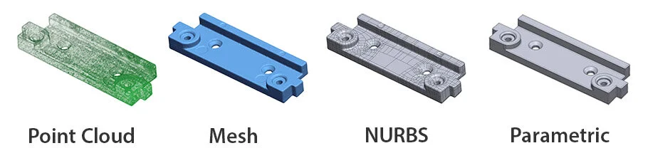
What is Point Cloud?
A point cloud file contains a collection of data points recorded in a three dimensional co-ordinate system.
Point clouds are created using 3D scanning equipment that collects a large number of points from the objects surface and records their location in space (X,Y,Z).
Point clouds can be provided raw, or with various levels of post processing. Processes such as filtering and optimization help to create a smaller file that is easier to work with.
Point clouds can be used directly for certain applications.
However it is more common for point cloud files to be converted into a Mesh file (.stl) or NURBS surface model.
Benefits
– Cheap and quick to produce
– Most accurate file type for inspection and measurement.
– Good for reference
Limitations
– Not compatible with a large number of CAD packages.
– Limited applications and requires will require post processing.
– Can often be large files that are difficult to work with.
Applications
– Reference data.
– Used to create a Mesh file or NURBS surface model.
– Inspection and measurements
by Toby Bradley, Laser Scanning Technician
Tel: +44(0)1709 546 453